11 November 2016
Greater Copenhagen
Infrastructure and the Green Economy for Distributed Quality
Infrastructure and the Green Economy for Distributed Quality
In 1947 Danish policy, with proven foresight and an eye toward the future, launched after a public discussion the Finger Plan, an ongoing model for urban development based on a major reorganization of urban transportation. The result has been the gradual transfer of residents from the historic center of Copenhagen out along service routes conceived for new urbanization.
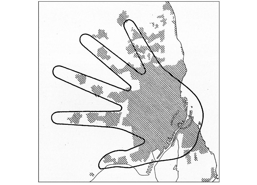
The population was convinced to embark on this radical move by the prospects for improved quality of living. The project’s success in achieving these ambitious aims was rewarded, in 2014, with Copenhagen’s selection by the European Commission as recipient of its green economy prize and the title of European Green Capital. The Finger Plan continues to boast widespread consensus due to the indubitable benefits it has brought about over the years, economically and otherwise. The plan’s graphic icon, an open hand which recalls Le Corbusier, vividly represents the urban core from which fingers radiate, representing rail and road networks as well as urban growth. These networks connect the peripheral area of the northern part of Denmark, an area known as Greater Copenhagen, around a single center, Copenhagen City. Between the “fingers” spread green zones rich in natural facilities where the entire population has easy access to farming and fishing.
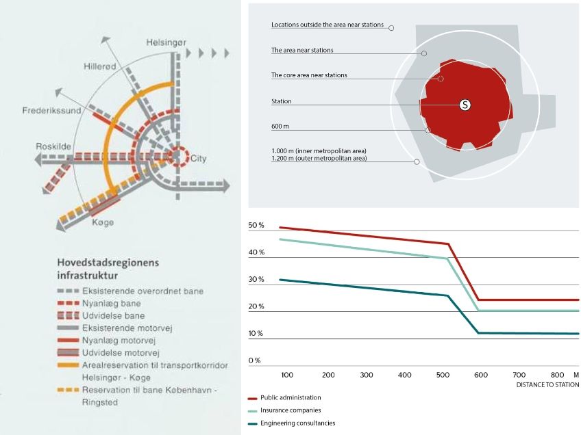
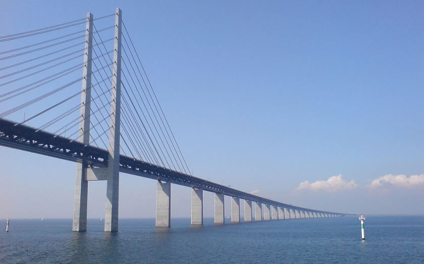
A key moment in the project’s evolution was the inauguration, in 2000, of the “sixth finger”: the Øresund Bridge which connects Denmark to Sweden. This bridge permits daily commuting between the two Nordic countries, increasing the region’s competitive advantage through urban regeneration and its ability to attract investors. The decision to locate stations within 600 meters productive centers proved instrumental in eliminating congestion by encouraging the use of public transit. In 2007 and later in 2013 Denmark’s Environmental Ministry was charged with managing general planning and specifically the Finger Plan. This ministry also coordinates the commerce plan for local and wide distribution, through the “Nature Bureau”.
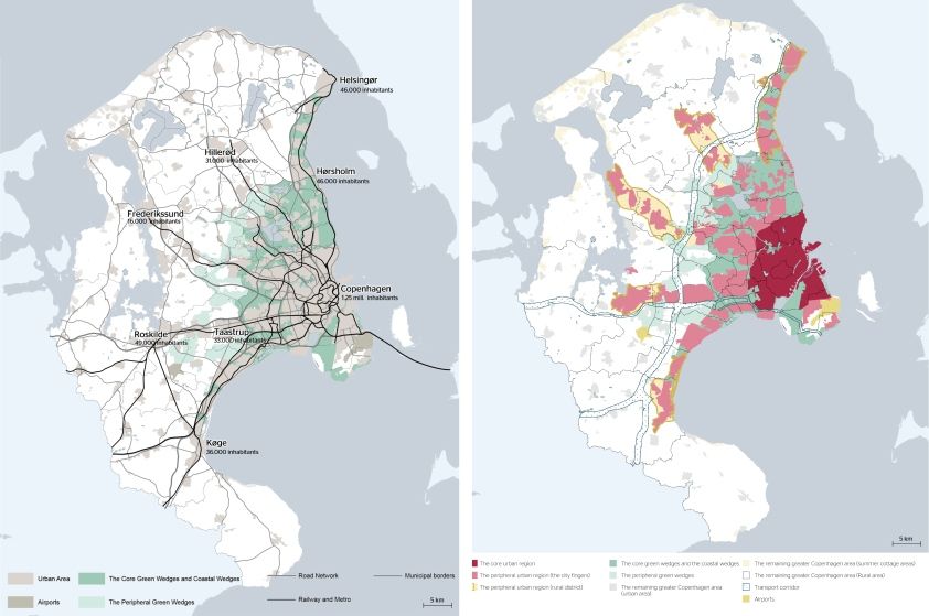
The Finger Plan continues to serve as the backbone for Greater Copenhagen’s regional planning, structuring development and regeneration for an area comprising the collaboration of 34 municipalities. Over the years, the plan has ensured an equitable provision for services, avoiding the imbalances between center and periphery which characterize many European cities, while at the same time generating a distributed urban identity and quality.


©Ministry of the Environment Denmark 2015
01 – Sketch from the first Finger Plan created by the Regional Planning Office in 1947. Courtesy ©Ministry of the Environment Denmark 2015
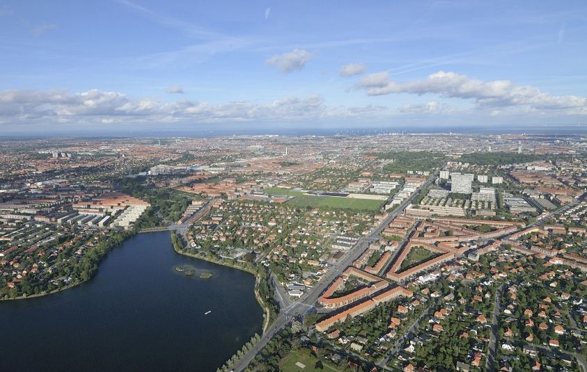
02 – Damhussøen in Copenhagen. Courtesy ©Ministry of the Environment Denmark 2015
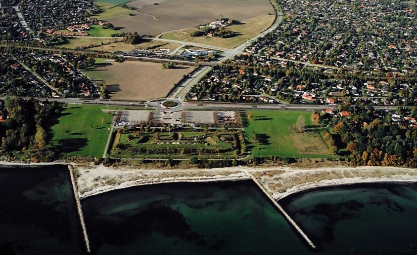
03 – City fingers and green wedges.Courtesy ©Ministry of the Environment Denmark 2015
04 – Greater Copenaghen: the 4 geographical areas. Courtesy ©Ministry of the Environment Denmark 2015
05 – Location near stations.Courtesy ©Ministry of the Environment Denmark 2015
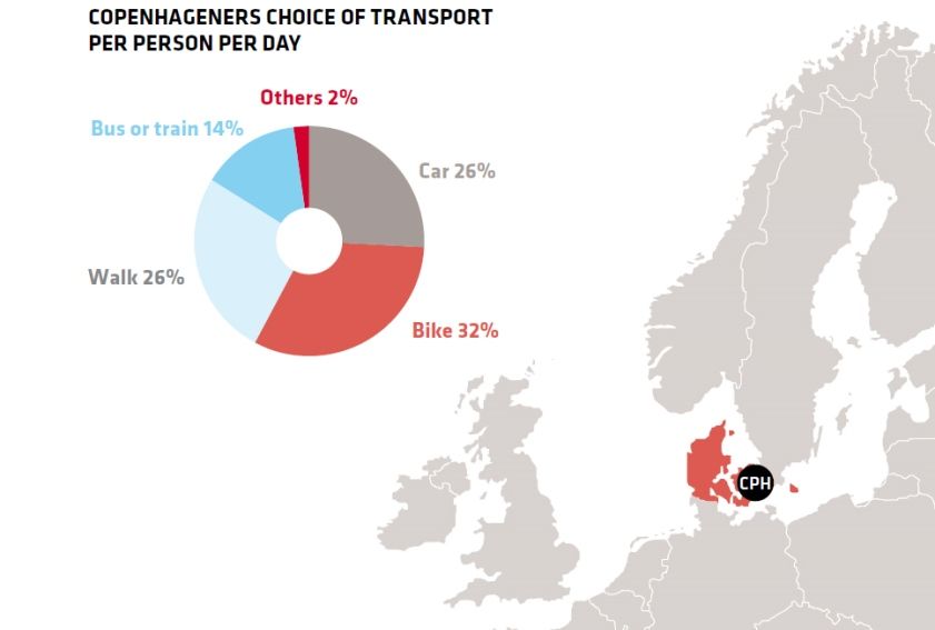
06 – Copenagheners choice of transport. Courtesy: TRAFFIC SAFETY PLAN 2013-2020
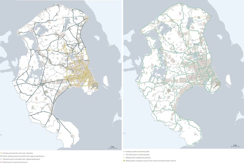
07 – Cycle path network for commuters and overall recreational path network. Courtesy ©Ministry of the Environment Denmark 2015
08 – Apartment buildings in Lyngby: collaboration projects.Courtesy ©Ministry of the Environment Denmark 2015
09 - Øresund bridge – Photocredits: Marcus Bengtsson